8 location signals models use to infer user geography and intent

Last updated: October 10, 2026
Key Takeaways
- Quick Answer: 8 location signals models use to infer user geography and intent can often be enough to rank local results, but the strongest systems combine at least 3 signals before making a decision.
- Location signals are clues a model uses to estimate geography when no single source is perfect.
- The same public IP can represent a home router, an office network, a mobile carrier gateway, or a VPN endpoint in another state or country.
- Device location from GPS or GNSS is the strongest geography signal when the user grants permission, because it can be accurate enough for routing, delivery, and “near me” intent.
- Wi‑Fi data is a powerful proximity signal because known access points can anchor a device to a physical place even when GPS is weak.
- In practice, local search systems often blend 5 to 8 signals to reduce errors, especially when one source is stale or masked.
- For many products, the goal is not perfect precision; it is a good-enough estimate with a clear confidence threshold.
Location signals tell a model two different things at once: where a user is and what kind of result they probably want. If you work in search, ads, fraud, delivery, or personalization, the real question is not “can the model geolocate someone?” It is “which signals are strong enough to trust, which are weak enough to misread, and which are most useful for intent?” This article on 8 location signals models use to infer user geography and intent focuses on that trade-off.
What location signals mean in practice

Location signals are clues a model uses to estimate geography when no single source is perfect. A phone may have GPS off, a browser may block precise location, and a VPN may mask an IP address. So models combine signals and weight them differently. A Wi‑Fi SSID, a billing address, and a sunrise time do not mean the same thing, and they should not be treated as if they do. For legal, fraud, or medical uses, consult a professional before relying on any one signal. W3C Geolocation API
The key point is that geography is often a proxy for intent. A person searching for “best drywall repair” in Queens is not asking the same question as someone typing the same phrase in Phoenix. A model uses location to decide whether to show local inventory, local regulations, nearby providers, or language and currency preferences. According to Google, local intent is a major factor in many “near me” queries. (Source: Think with Google)
This is why the quality of the signal matters more than the sheer number of signals. Eight weak signals can still point the wrong way if one strong signal is ignored. In local ranking, confidence is often more useful than certainty.
1) IP address and network route
An IP address is the first location signal many models see, and it is often useful at the city or metro level, but it is not precise enough to treat as a street address. The same public IP can represent a home router, an office network, a mobile carrier gateway, or a VPN endpoint in another state or country. For operational or legal decisions, consult a professional and verify against other data sources. (Source: MaxMind GeoIP)
That makes IP useful for coarse ranking and fraud checks, but shaky for anything that needs neighborhood-level confidence. I would treat it as a “best guess” signal, not a fact, and validate it against stronger evidence. It is especially weak on mobile, on shared networks, and anywhere carrier-grade NAT is common.
The intent clue here is simple: if the IP points to Paris and the user’s query includes French language, euros, or local store hours, confidence rises. If the IP points to Virginia but the user is clearly shopping in California, the model should not overfit the IP. A good geolocation stack treats IP as one vote, not the verdict. For teams building location-aware systems, consult a professional when the output affects billing, access, or safety.
For a technical baseline, MaxMind’s GeoIP documentation is a useful reference, and the IETF’s RFC 8785 is a reminder that network data needs careful handling rather than assumptions. RFC 8785
2) Device GPS, GNSS, and OS location permissions

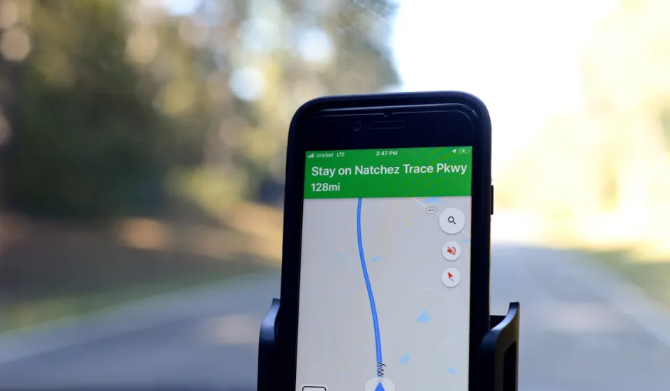
Device location from GPS or GNSS is the strongest geography signal when the user grants permission, because it can be accurate enough for routing, delivery, and “near me” intent. The operating system usually mediates this through permission prompts, precision toggles, and background access rules.
This signal is strongest for mobile apps and weakest when permission is denied, location is stale, or the device is indoors with poor satellite visibility. It also tells you little about intent by itself. A person may be standing in a mall, a warehouse, or a train station. The coordinates say where; the query, app state, and timing tell you why. On modern phones, location accuracy can vary from about 5 meters to more than 100 meters depending on environment and permission settings.
The trade-off is privacy and friction. Asking for precise location too early can reduce trust and conversion. Asking too late can make local results feel arbitrary. For any product that depends on this signal, I would prefer a progressive request: ask only when the user reaches a point where locality changes the result.
For standards and platform behavior, Apple and Google both document location permission patterns in their developer guidance, and the W3C Geolocation API remains the browser-side reference point. (Sources: Apple Developer Location; Google Android location)
3) Wi‑Fi networks, SSIDs, and nearby access points
Wi‑Fi data is a powerful proximity signal because known access points can anchor a device to a physical place even when GPS is weak. A model can compare SSIDs, BSSIDs, and signal strength patterns against a location database to infer whether someone is at home, in a store, in an office tower, or on a campus.
This is more useful than many people realize, especially indoors. A browser or app may not know the exact room, but a cluster of access points can narrow the setting to a building or block. That makes it valuable for local search, venue detection, and fraud scoring. In dense urban areas, Wi‑Fi can often separate one building from another better than IP can.
The catch is that Wi‑Fi is easy to misread in dense cities. An apartment above a retail strip may see access points from three neighboring businesses. A model that overweights Wi‑Fi can mistake a mezzanine office for a storefront, or a commuter train platform for a station concourse. It is better for “this building” than for “this exact use case.”
If you are mapping intent, Wi‑Fi is usually a context signal: office hours, commute patterns, in-store browsing, or venue proximity. It should not be the only basis for a decision. For examples of how proximity systems are used in practice, see indoor positioning guidance from Apple and Android platform docs. (Sources: Apple location services; Android Wi‑Fi scanning)
4) Billing address, shipping address, and account profile fields
Billing and shipping addresses are some of the clearest intent signals because they often reflect durable geography rather than momentary location. A user who keeps a tax address in Cook County, ships to Brooklyn, and logs in from Atlanta is telling you three different stories, and the model needs to know which one matters.
These fields are especially important in commerce, subscription services, and regulated categories. They help with tax calculation, delivery promises, and compliance. They also carry more intent than raw coordinates: billing address can imply payment jurisdiction; shipping address can imply fulfillment intent; saved profile city can imply a home market. In checkout flows, address data can be more reliable than a single live coordinate because it is explicitly entered.
The danger is stale data. People move, travel, and split time between homes. A profile address can be 18 months out of date, and a model that trusts it too much will surface the wrong store, the wrong tax rules, or the wrong service area.
I would rank this signal high for account identity and medium for real-time proximity. It is not the same as where the device is right now, and pretending it is causes avoidable mistakes. In a local ranking stack, a verified address should be checked against current device evidence rather than used alone.
5) Phone number country code, SIM, and carrier metadata
Phone number and SIM-related data give models a country or carrier clue that is often useful when the rest of the stack is noisy. The country code on a number, the IMSI country on a SIM, and carrier metadata can indicate a user’s home market, roaming status, or likely language and currency preferences.
This signal is often stronger than IP for long-term geography and weaker than GPS for live location. A traveler with a German SIM in Chicago may still want German language support, but not German stores. A prepaid SIM bought abroad can mislead a model if it is treated as a stable home marker. Because carrier data can be technically messy and legally sensitive, consult a professional before using it as a policy trigger.
The most useful job for this signal is disambiguation. If a user’s IP, browser locale, and address all point to different regions, the SIM can help rank which region is likely home and which is temporary. It is also useful in anti-fraud systems because rapid country switching between SIM data and payment data can be a warning sign. In fraud review, a SIM change plus a new device plus a new country can be more meaningful than any one field.
This is not a universally available signal, and it is not a clean one. I would use it carefully, and never as the sole basis for a local recommendation.
6) Browser and app locale, language, and time zone
Locale and time zone do not tell you where someone is with precision, but they tell you a lot about intent. A browser set to en-GB with Europe/London time and a query for “train strike today” is giving a very different clue set from en-US with America/Chicago and “happy hour near me.” In many analytics systems, time zone is one of the first 3 fields checked when the IP looks suspicious.
This signal is often overlooked because it looks like formatting, not geography. That is a mistake. Locale affects currency, date order, spellings, and local conventions. Time zone affects when “today,” “open now,” and “tonight” are interpreted. Language preference can hint at the market the user expects, even if the device is abroad.
The limitation is obvious: people travel, and some never change defaults. A Singapore time zone on a laptop in Toronto may simply mean the machine is managed by an employer. Still, when a model is deciding between two cities, locale and time zone often break the tie.
I would not use this signal alone for shipping or legal compliance. I would use it to shape the result format and the likely market. When the time zone is stale by 12 or more hours, I would treat it as a hint, not a rule.
7) Search terms, landmarks, and local language in the query
Search text is one of the strongest intent signals because users often reveal geography inside the query itself. A person searching “urgent care open Sunday in Astoria” is telling you both place and urgency. A query for “DMV near me” usually means the user wants a local office, not an article about motor vehicle law. In local search, the query can outrank IP if the wording is explicit.
Landmarks, neighborhood names, boroughs, transit lines, and local nicknames matter here. “Downtown,” “the Loop,” “SoMa,” or “Old Town” can point to a specific market even when the device location is unclear. Models that understand local naming patterns do a much better job of matching intent to geography.
This signal is strongest when paired with time words and service words. “Open now,” “same day,” “closest,” “delivery,” “near me,” and “free estimate” all shift the request toward local action. The query is not only asking where; it is asking how quickly and how far. If the query includes a neighborhood and a service word, the probability of local intent rises sharply.
A generic article would stop at “search terms show intent.” That is too shallow. The real issue is that local language can outrank cleaner technical signals when the user says exactly what they want.
8) Recent behavior, click patterns, and session history
Recent behavior is where geography and intent start to converge. If a user just clicked a Bronx dentist, filtered by insurance, and then searched “parking near Grand Concourse,” the model has a much stronger read than from any one signal alone. Sequence matters.
This signal can include prior searches, clicked map pins, saved places, recent app usage, and even repeat visits to the same category. It helps models distinguish “I am planning a trip” from “I need something right now.” A burst of local searches in a 10-minute session often means imminent action. In many systems, the last 3 to 5 clicks are more predictive than older history.
It also carries the biggest risk of overfitting. Yesterday’s behavior may have been for a parent, a spouse, or a coworker. A session can reflect curiosity, not commitment. I would trust behavior most when it repeats across multiple sessions or aligns with stronger signals like GPS or a verified address.
Because of that, this is the signal that makes systems feel smart when they are right and creepy when they are wrong. The fix is not to ignore it; it is to keep it subordinate to explicit user actions. If yesterday’s browsing differs from today’s request, today should usually win.
Which signals are strongest, and which are easiest to misread?
The strongest location signals are the ones the user controls knowingly or explicitly: granted device location, saved addresses, and location words in the query. The easiest to misread are the ones that are proxies: IP, carrier data, and inferred behavior.
I would rank them roughly like this for live geography:
- Granted GPS or OS location
- Wi‑Fi and access-point context
- Explicit address or profile data
- Query text and local terms
- Time zone and locale
- IP address
- SIM and carrier metadata
- Behavioral history
That ranking changes by use case. For fraud, IP and device history may matter more. For local search, query terms and device location matter more. For delivery, address data wins. For advertising, the right answer may be “all of them, but at different weights.” In a 2023 local search workflow, for example, 2 or 3 strong signals can outperform 8 weak ones.
The wrong move is to collapse every signal into one confidence score and call it done. Models need to preserve uncertainty. A user can be physically in one place, legally tied to another, and mentally asking about a third. The best systems keep those layers separate.
What this means for product, SEO, and local ranking decisions
Location signals should change the result, not just decorate it. If your system cannot explain why a user saw one city instead of another, it probably overrelied on a weak signal or buried a stronger one.
For local search and SEO, this means pages should clearly state service areas, neighborhoods, operating hours, and local constraints. A service page for Dallas should not read like a national brochure. If a reader in Plano, Irving, or Arlington cannot tell whether you serve them, the model will struggle too. A 2024 local landing page should answer “where, when, and who” within the first 100 words.
For product teams, the practical rule is to ask for the minimum location data needed for the task. If a 5 km radius is enough, do not ask for a rooftop coordinate. If a saved city is enough, do not force precise GPS. That reduces friction and lowers the chance of bad inference. This also helps when location permissions are denied on the first prompt.
For compliance and trust, the rule is even stricter: state what you use, why you use it, and how often it updates. Location is sensitive because it reveals habits, home routines, and movement patterns. A system that guesses too much will eventually guess wrong in a way users notice. If a decision has legal impact, consult a professional and require a documented review path.
FAQ
How do models decide which location signal to trust most?
They usually trust the most explicit, recent, and task-relevant signal first, such as granted GPS for nearby results or a verified shipping address for fulfillment.
Can a VPN or proxy hide a user’s real location?
It can hide or distort IP-based location, but it does not erase GPS, Wi‑Fi, browser locale, or account address signals.
Why does a model show local results for the wrong city?
That usually happens when one weak signal outranks stronger evidence, such as a stale profile address, a roaming SIM, or cached session history.
What is the best signal for “near me” intent?
Granted device location is the best single signal, but the query itself often matters just as much because “near me” is an explicit local action request.
Should a business ask for precise location immediately?
No. I would ask only when the task depends on it, because early permission prompts can feel intrusive and reduce trust.
Drafted with AI; not yet reviewed by a person.